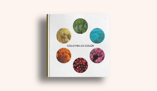
Colombia is color
Villegas Editors: Colombia is color
Text: Juan David Giraldo - Carolina Jaramillo
Photos: Art Department Villegas Editores
The first edition of the book Colombia is Color was published in 2008 by Villegas Editores, in it we will find another dedication to the love we feel for Colombia, taking a tour of the different regions of the country and making known its landscapes, its fruits, its artifacts and its people.
Below is an excerpt from his introduction:
“The diversity of colors is overwhelming when you observe the dazzling Colombian landscape. In the 32 departments, in the powerful Western, Central and Eastern mountain ranges, in the Atlantic and Pacific oceans, the immense chromatic display is presented with the forcefulness if chromatic, of course, were representative of a great work of art. Of all the colors, it is clear that green is the most outstanding. Curiously, this color is not found in the national flag, the symbol par excellence in which the chromatic highlights with greater vividness and whose origin dates back to March 12, 1806. That distant and inaugural day, during the invasion of the Venezuelan population from Coro, aboard the sailboat or brig Leandro, the precursor Francisco de Miranda waved for the first time, with serene distinction, the yellow, blue and red tricolor.”

“About the meaning of the national colors, there are many versions that have not succumbed to oblivion. Starting with the fiery words (colorful words, let's say) that Francisco Antonio Zea pronounced at the Congress of Angostura in 1819: "Our national pavilion, symbol of public liberties, of redeemed America, must have three stripes of different colors: be first yellow, to signify to the people that we love and love the federation; the second blue, the color of the seas, to show the despots of Spain that the immensity of the ocean separates us from their ominous yoke, and the third red, with "in order to make the tyrants understand that before accepting the slavery that they have imposed on us for three centuries, we want to drown them in our own blood, swearing war to the death in the name of humanity."
“Other less heated versions point out that the yellow and red colors were taken from the Spanish flag; blue, by the way, was introduced to signify distance from the motherland. But there are other versions; There is even one that refers - it really seems like a bedroom murmur - that Miranda took those three colors as a gesture of gratitude towards the Empress Catherine of Russia, her friend: yellow (her hair), blue (her eyes) and red. (her lips)."

“As for the official version, which is the one that circulates through the collective imagination, the meaning would be the following: yellow represents sovereignty, harmony, justice, abundance and the richness of the soil; blue symbolizes the sea, the two oceans on which Colombia has coasts; and red represents blood, life, love, power, strength and progress.”

“Maybe there is, in that latest version, a keyword. That word is the word wealth. That may be the one that best defines the chromatic qualities of the captivating Colombian landscape. That is why it is not so hateful to compare it - if the chromatic, let us emphasize, were the representative with a work of art. With a great fresco, let's think. With a great fresco where several elements converge: the different natural regions, the many tourist attractions, the many musical rhythms and the distinctive gastronomy of each place. And the colors, of course, that have already appeared in the journey prior to the creation of the work. The tour, at least on this occasion, begins in the Caribbean region. Located north of the Andes, this vigorous plain ends in the Sierra Nevada de Santa Marta and is the largest and most impressive mountain range in Colombia.”
“It has the enormous beauty of the Cristóbal Colón and Simón Bolívar peaks, two true emblems of the heights and the pure white that rests on their summits.
The Caribbean region is marked by the amazing Magdalena delta and has a significant coastline - the highest in the world - that extends from the Gulf of Urabá to the Gulf of Venezuela. Primarily flat, the region is characterized by its ecological variety: in its ecosystem you can see the colorful jungle of the Gulf of Urabá region or the imposing dry forest of La Guajira. This department is divided into upper, middle and lower Guajira. Decidedly desert, the territory is bathed by the Ranchería, Carraipía, Palomino and Jerez rivers.”
“With temperatures between 27 and 30 °C, La Guajira has a population made up of mestizos, whites, indigenous people and Afro-Colombians. Among its most renowned tourist attractions are the Los Flamencos Fauna and Flora Sanctuary - with the natural attraction of the swamps of Manzanillo, Laguna Grande or Tocoromana, and with the attractive pink plumage of the flamingos; the Serranía de La Macuira National Natural Park - with an ecosystem, not at all desert-like, where mountains and forests and water sources converge for the grace of the ocelots and monkeys and deer and guacharacas and bluebirds that populate the area; and Cabo de la Vela - with places as striking as the Lighthouse and the PiIón de Azúcar hill, the latter with a special mythological meaning for the Wayuu, since they believe that when they die their souls pass through that place, where the extensive golden beaches They are framed in the deep blue of the sea.”

“On the tour of the Caribbean region there are other attractions: the famous corals of the Rosario Islands, the famous Ciénaga Grande de Santa Marta, the universally touristy Tayrona National Natural Park or the beautiful Los Colorados Fauna and Flora Sanctuary. And the music, the music that cannot be missed, the music with the bagpipes and the drums and the maracas of the cumbia or the porro. At the annual dances, women wear skirts or skirts, wear candongas, a headscarf, and heavy makeup that never goes unnoticed; The men, for their part, dress in heavenly white, with their pants rolled up and the famous vueltiao hat.”
“In the necessary fields of gastronomy, the typical food is the sábalo sancocho or bocachico, in thick pieces, with two heads of large fish, cassava, green banana, yellow banana, coconut milk, lemon, stew, ground thyme, salt and pepper, all the color placed on the table. And so, from the Caribbean region to the Andean region. Although to the south, the Andes form a mountain range with dizzying volcanic peaks, to the north, at the nodes of Pasto and Almaguer, they are divided into three mountain ranges: Western, Central and Eastern. The Central mountain range is separated from the Western one by a geological fault between the Patía river - the longest on the Colombian and South American Pacific coast and the Cauca river, which rises in the splendid Sotará wasteland, in the Colombian Massif, a strategic area both at the national and international levels by virtue of water production; For this reason it is known by the name "water star".
 “The Eastern mountain range, for its part, gradually separates towards the east, creating the Magdalena River basin, undoubtedly the most important river route in Colombia. A large hydrocarbon reserve, with a significant position in pre-Columbian times, the Conquest and the independence struggles, the Magdalena River has been the subject of songs and legends and armed conflicts. Perhaps the most memorable description of his torrential temperament appears in the novel The General in His Labyrinth by Gabriel García Márquez: "The heat became intolerable during the day and the commotion of the monkeys and birds became maddening, but the nights were stealthy and cool. The alligators remained motionless for hours on the beaches, with their jaws open to hunt butterflies. Next to the deserted hamlets you could see the corn fields with live bone dogs that barked at the passing of the boats, and even in unpopulated "There were traps for hunting tapirs and fishing nets drying in the sun, but not a human being was seen."
“Finally, the Eastern mountain range extends to the northwest and reaches its highest altitude in Boyacá, forming the Sierra Nevada del Cocuy before entering Venezuelan territory, where it acquires the name of the Mérida mountain range. With great climatic diversity, the Andean region does not have a predominant group of inhabitants: Paisas, Santandereanos, Opitas, Vallunos, Pastusos and Cundiboyacenses share a territory marked by the din of history. In the Cundiboyacense plateau are the Guatavita lagoon with the gold of the unforgettable legend echoing in memory, the Zaque Cushions, the Donato Well, the historic Boyacá bridge, where the bata that sealed the independence of the country on August 7, 1819; In that space, the famous meeting between Gonzalo Jiménez de Quesada, Sebastián de Belalcázar and Nicolás de Federmann also took place in 1538. In agriculture, the crops of potatoes, corn, wheat, barley and soybeans stand out.”

“In the department of Nariño there are high temperatures, abundant rains and exuberant vegetation. The tourist destinations are varied: the vibrant Sanctuary of Las Lajas, the peaceful and beautiful lagoon of La Cocha, the disturbing island of La Corota, the rigid snow-capped mountain and lagoon of Cumbal, the authentic knot of Los Pastos, the healthy hot springs of Ipiales. and La Cruz, the advantageous island of Tumaco, the venerable beach of Bocagrande, the undisturbed Sanquianga National Natural Park and the already renowned Galeras flora and fauna sanctuaries. In its gastronomy, boiled dishes, fruit juice with rice water, Nariñense sponge cake, mostachones, ají de queso, aged empanadas, lapingachos, guinea pig or lomo biche encebollado stand out. As is traditional, the Black and White Carnival is celebrated in the first week of January.”

“Valle del Cauca has been the birthplace of great artists: Omar Rayo, Enrique Buenaventura, Gustavo Álvarez Gardeazábal, Andrés Caicedo or Jorge Isaacs. The following fragment from Once Upon a Time Colombia (Villegas Editores), by William Ospina, describes well the topography of the department: "Thus comes the descent towards the Valle del Cauca, again in the violent light of the tropics, wide plains cut in the distance by the blue and remote wall of the western cliffs, the vertical mountain range of basalt walls behind which the Pacific storms stir. This is Jorge Isaacs's Maria Valley, which is not only the story of a love romantic, but a detailed description of what the landscapes of this region of America were like at the end of the 19th century, what life was like on the large haciendas, their peasants, the hazards of the tiger hunt, the struggle of human beings in the wild nature, the horsemen who cross swollen rivers at midnight, those who descend through the canyons of the Dagua River, among enormous rocks, mosses, ferns and very pure waters, coming to search for the valley from the hidden dock of Buenaventura , the main port on the Pacific".
“In Huila, among many other wonders, is the opulent San Agustín Archaeological Park, one of the most important archaeological spaces in Colombia and declared by UNESCO as a world heritage site in 1995. In this department, there are also the Puracé National Natural Park, the Cueva de los Guácharos National Natural Park, the admirable Betania dam, the windy and calm Tatacoa desert and the temperamental snow-capped Huila. For its part, Tolima can boast of being the musical region of Colombia: there are the festivals of San Pedro in Espinal, San Juan in Natagaima and the Colombian Folk Festival and the Garzón y Collazos Duet Competition in Ibagué.”

“The department of Santander, on the other hand, has an economy based on oil, gold and electrical energy. Among the most representative tourist places are Barichara with the white facades of its houses and its fiery sunsets, worthy of an absolute postcard in homage to the old colonial beauty, the discreet charm of San Gil, the impetuous and frightening Chicamocha canyon and the knot of Santurbán, which later becomes the Motilones mountain range. Of its cuisine, it is worth mentioning the culona ants, the mute, the tamales, the cabrito or the pepitoria.”
“From a geographical point of view, talking about Antioquia is talking about mountains: 80% of its territory is extremely mountainous; Medellín, not in vain, has been called Capital of the Mountain. However, the remaining 20% of the territory is made up of flat areas. The immense valley of Aburrá, the magnetic plateau of Santa Rosa de Osos, the attractive valley of Rionegro, the strategic and exuberant Paramillo National Natural Park and the moderately picturesque Las Orquídeas National Natural Park are part of its tourist attraction.”
“As factors for the development of its economy, mining, cattle ranching and financial services can be mentioned. Additionally, the production and distribution of electrical energy, gold, coal and platinum mines and the textile industry complement its economic potential. “A panoramic view of the José María Córdova airport without counting the metro and metrocable of the capital of Antioquia would be just a good example of the transportation systems it has.”
“Of the many artists born in that land, one could remember the names of Fernando Botero, Débora Arango, Rodrigo Arenas Betancourt, Baldomero Sanín Cano, Estanislao Zuleta or Manuel Mejía Vallejo, among many others. The bambucos, hallways, Creole waltzes and songs, as well as a wide Latin American repertoire of tangos, boleros and rancheras,
They add to the musical repertoire of the region. Likewise, the Metropolitan Theater of Medellín, the Pablo Tobón Uribe Theater, and the Porfirio Barba Jacob Theater clearly indicate its vitality in this field of the arts.”
“At this point, the route then reaches the Pacific region. Located to the west and divided into two gigantic areas marked by Cape Corrientes, this region borders to the north with Panama, to the south with Ecuador, to the east with the Western Andes mountain range and to the west with the Pacific Ocean, from which it takes its name. It has great ecological, hydrographic, mining and forest wealth. The lively mountain ranges of Baudó and Darién predominate in the relief, in addition to the valleys of the Atrato, Baudó and San Juan rivers, recognized for their powerful flow.
With a humid tropical climate, the temperature ranges between 28 and 32 °C. The frequent winds that arrive from the Pacific loaded with humidity, which collide with the Western mountain range and produce river precipitation, have placed the Pacific region as one of the rainiest on the planet; in Chocó it rains for two thirds of the year; “These precipitations increase the flow of rivers and create equatorial jungle vegetation.”

“El Chocó, moreover, is the only Colombian department with coasts on the Pacific Ocean and the Atlantic Ocean. Composed of mostly black or Afro-Colombian people, it has three important natural parks of indescribable value: Katíos, Utría and Tatamá. Among the most striking tourist places for foreigners are Nuquí, Quibdó and Bahía Solano, whose contrasting colors are etched in the memory of visitors. In this same sense, it is worth mentioning such memorable places, with a perfect dose of natural beauty, such as Humboldt Bay, Cape Corrientes, the Alto Puna or the Darién Gap, which was recognized by UNESCO in 1983 as a world heritage site and biosphere reserve by virtue of its forest, animal and water wealth.”
“In the musical field, the black communities of the Pacific have two outstanding manifestations: the shawm, in Chocó, and the marimba ensemble, in the south of the coast, which has a strong European influence, with particular features, both rhythmic and instrumental, African music. In the gastronomic field, the snapper sancocho in coconut milk, the Creole chicken sancocho or the Milanese-style sea bass, are part of the typical dishes of the area, without forgetting the famous borojó juice, the flagship fruit of Chocó.”
“Continuing with the tour, the crucial region of Orinoquia now appears, which basically covers the eastern plains of the country. With an economy based on livestock and oil extraction, this region played a determining role in the independence struggles. One of its greatest emblems is the excellent Macarena mountain range, which was the first national nature reserve established by law of the republic in 1948 and was established as a Natural Park in 1971. Due to its height, the mountain range has several thermal floors and is a privileged point where the fauna and flora of the Amazon, the Orinoquia and the Andes converge; “The unmatched and abundant biodiversity has resulted in numerous endemic species.”
“The exotic humid jungles, forests and bushes - dense and clear, with a striking luminosity - make up its exciting ecosystem. Internationally known for the extraordinary wealth of Caño Cristales, the mountain range has wonderful waterfalls and incomparable rapids. Angostura, on the Guayabero river, and Cafre channel, on whose rocky edges petroglyphs abound.”
“The Eastern Llanos, for its part, is a vast region located in the Orinoco River basin. It is considered one of the most important ecosystems in the world, with two distinct seasons - the rainy season and the dry season. Characterized by its extensive savannas and its intertropical climate, the economic importance of the plains lies in the quality of the land, suitable for extensive livestock farming and agriculture. The writer Getulio Vargas Barón, in "Amanecer llanero", describes it like this: "Loving plain, goddess of mystery, concubine of silence, the sun bathes you in light when the day dawns and in the hour of twilight it deposits its loving kiss of colors in the emerald green of your sheets, to be confused in the august stillness of the night, watched from infinity, by the moon of jealous hope." Precisely the llanero - a word derived from the plains - is the figure associated with the horseman who is dedicated to the care of livestock on the large estates of the region; "This occupation dates back to the times of Independence."
“On the plains, whose mix of colors is unparalleled, the bravery of the plains man becomes the memory of the country. The joropo popular dance of the plains of Colombia and Venezuela is characterized by fast movement, at a ternary rhythm, with a slight reference to the waltz. Undoubtedly, it represents the most genuine expressive form of the manifestations of colonial music. Although it is the least populated area of the country, the complex Amazon region comprises 29% of the national territory. At the same time, it is part of the greater region
South American Amazon jungle, the largest forest area in the world, shared by Venezuela, Brazil, Colombia, Ecuador, Peru and Bolivia.”
“Among the most relevant rivers are the Inírida River, whose striking mouth is in the department of Guainía; When it flows into the Guaviare River, its waters lose the dark color produced by plant residues and acquire a yellowish color.
With a territory profusely covered with jungle, crossed by long and mighty rivers, with countless lagoons and swampy areas, the department of Amazonas has great ethnic wealth by virtue of the Amerindian cultures that resisted the times of the Conquest and the Colony.”

“Within the most fortunate of its relief - true postcards with a constant exceptional brilliance - we can mention the fantastic Cumare and Otare hills, the exultant Chiribiquete mountain range, the prodigious San José mountain range and the solemn Amacayacu National Natural Park. In relation to its gastronomy, the variety is as wide as it is exquisite: ahuyama capon, rice bread, offal, picadillo and the now classic guarapo.”
“Fish, in its different forms, is accompanied by fariña cassava flour that constitutes the indigenous diet, aguadepanela and banana chicha. But that is not all. There is more, much more: the casabe, the river turtle stew - with potatoes, yucca, tomatoes, onion and coriander leaves -, the pirarucú balls or the caimarón. In this region, the woman wears a flowery mid-calf skirt and white blouse with native belts and necklaces; “The men wear fisherman suits, white pants and colored shirts, also with handmade necklaces.”
“The tour of Colombia could continue, of course. In fact it could become an absolutely endless journey. However, what has been undertaken in these pages - there are, of course, numerous places and tourist destinations that have been omitted for reasons of space - has the modest claim of wanting to cover everything; or, at least, to cover the most representative of the exclusive Colombian geography. At this point, then, the tour must end. It goes without saying that along the way there have been impressive representations of Colombian diversity, all with their respective characteristics, with their diverse climates, smells and flavors, with colors representative of the endless chromatic richness of the national territory. Perhaps, a fundamental aspect has already been fulfilled: gathering the experience necessary to create the great work of art.”
“Now everyone will be able to create – in a mental representation as intimate as it is endearing – the great fresco mentioned at the beginning.”
Giraldo, Juan David and Jaramillo, Carolina; “Colombia is Color”; 2008; Villegas Editors, Introduction.
